|
2.06 Acres |
|
|
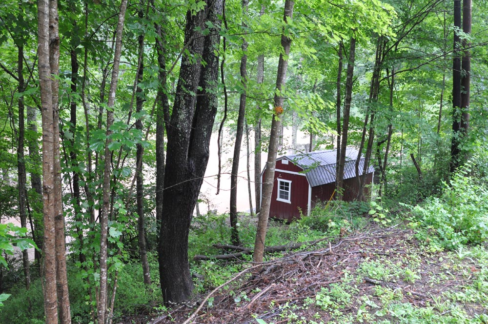
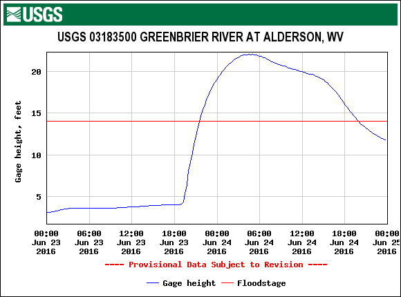
The catastrophic flood of June 23-24, 2016Oh boy! That was a flood to impress Noah.
|
|
|
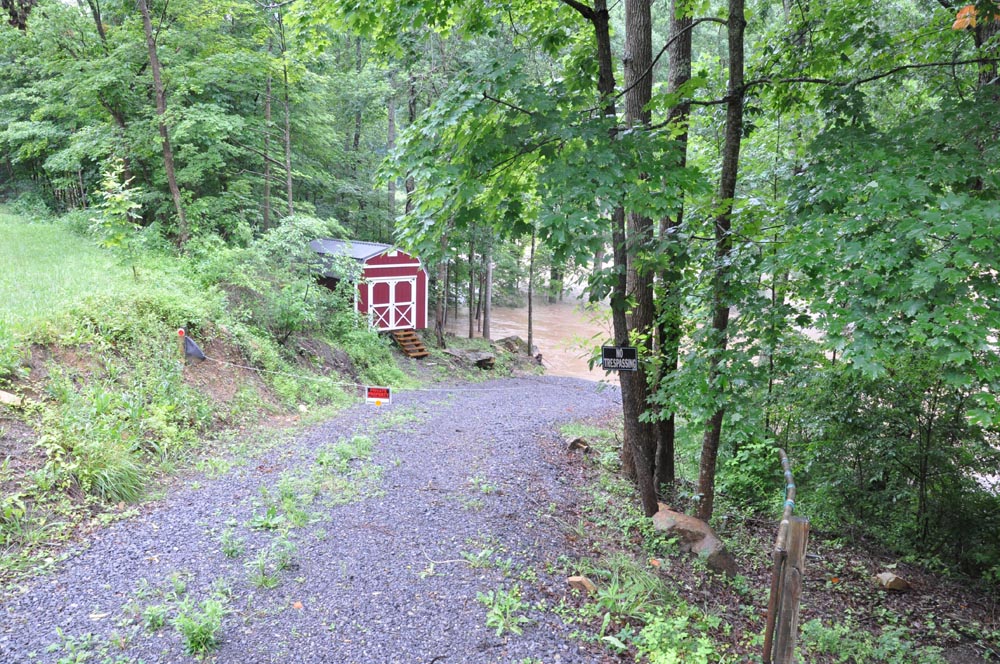
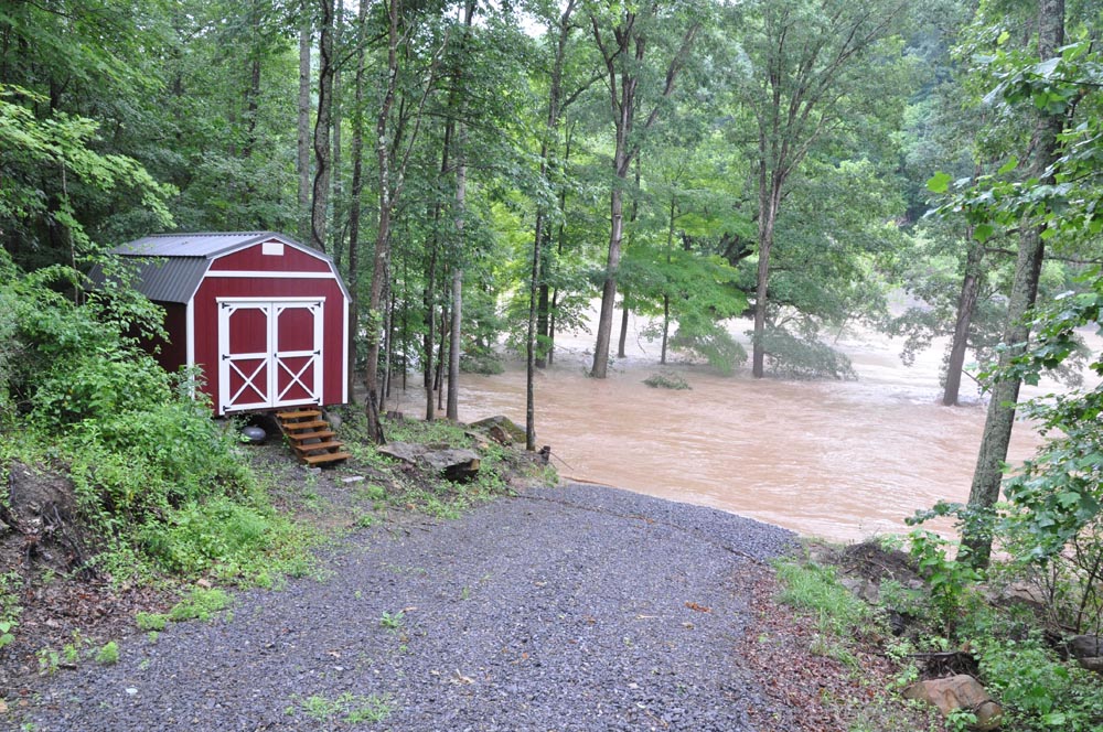
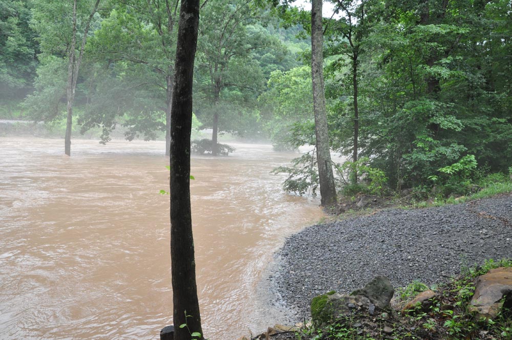
Photos taken the afternoon of June 24, 2016 after flood had receded somewhat:
|
|
|
|
|
|
|
|
|
|
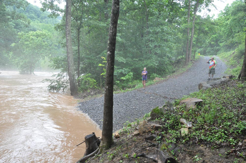
The two photos above show the lot viewed from Highland Trail, with the Greenbrier River still flooding.
|
|
|
|
|
|
|
|
The above photo shows my driveway entrance to the lot, taken from the highway.
|
|
|
|
|
|
|
|
A little closer. The shed was high and dry, with the crest several feet below. I marked the crest with a paving stone that remains in place.
|
|
|
|
|
|
|
|
My camper was gone! The photo above is looking directly to where the travel trailer was parked.
|
|
|
|
|
Note the mark of the high water crest left across the driveway just in front of my wife's feet.
|
|
|
|
|
The photo above was taken the next day, June 26, 2016. I guess I learned a valuable lesson.
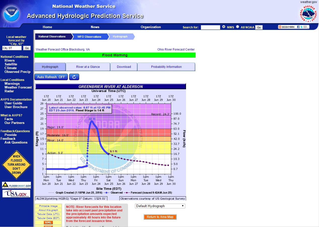
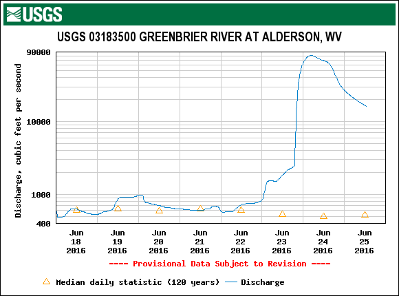
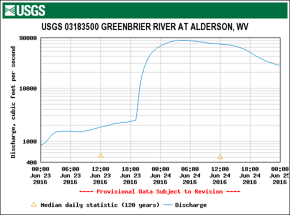
The following is data taken from the National Weather Service and USGS websites. These graphs document the timing and extent of this flood event. |
|
|
For me, it was time to start some new planning. |
|
|
CLICK HERE TO GO BACK TO THE FIRST PAGE
|